CANMAPS
cost path analsys on mars
The purpose of this map was to show the most efficient way beetween two points. It show the Northeast Syrtis region of Mars, wich was a candidate for the landing of the Rover mission in 2020. Cost path analsys is a tool using in GIS to find the shortest way beetween two points. I follow this tutorial. The source of data can be found Here. It was made with SAGA GIS.
Original

map for calis association
Calis map
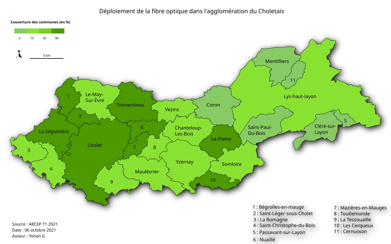
This map was made during an internship at Calis association. It show the deployment of high-speed internet in the area of the association. The data comes from Here (for the optical fiber) and from Openstreetmaps for the background map. It was made using QGIS and Inkscape. It is intended to serve as an illustration of a territory diagnosis.

hospital suitability in vancouver
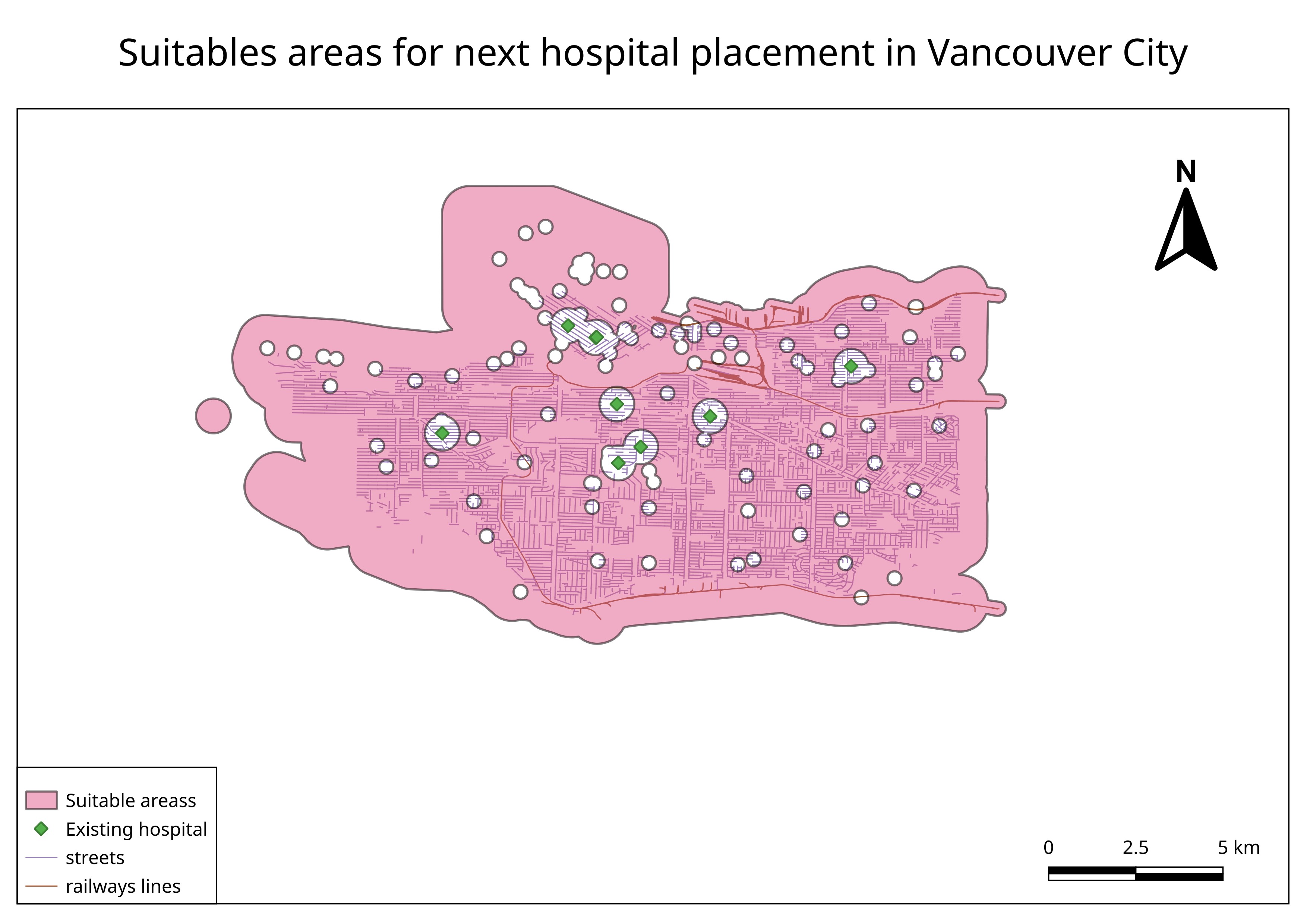
This map show the most suitable area for a new hospital in Vancouver, according to these criterias :
- existing hospital : At least 500m away
- Residential Area : Around 100m
- Railway : less than 100m
- Street : less than 100m
- Public toilet : At least : 200m
- fire hall : less than 500m
